The Wadden Sea is a large area of tidal flats, mussel beds and seagrass meadows that are exposed at low tide. It is located between land and sea and stretches from Esbjerg in Denmark, Schleswig-Holstein and Lower Saxony to Den Helder in the Netherlands. It is about 450 kilometers long and between 5 and 20 kilometers wide. In addition to the tidal flats, mussel beds and seagrass meadows that are exposed at low tide, it also includes salt marshes located in front of the dikes.
The Wadden Sea is an area adjacent to the beach and located at the high tide line. At first glance, the area seems to be lifeless. However, upon closer inspection, this is not the case. It is teeming with life because the rivers and sluices that flow into the tidal flats deposit a large amount of fertile material. The mudflats are characterized by a high water content, which causes visitors to sink in the mud. It happens that it smells like rotten eggs and you get black feet. This is not due to the tar deposits, but to the hydrogen sulfide that is released during the anaerobic, i.e. oxygen-free, decomposition of organic material.
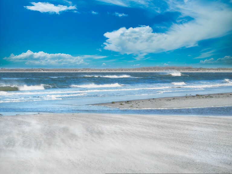
At low tide is spanned by several small river beds called tideways. This process is caused by the interaction between the moon's gravity and the Earth's oceans. The Moon's gravity pulls on the Earth, causing the oceans to bulge toward the Moon. This bulging of the oceans causes high tides. When the tides are high, the water level in the riverbeds is also high, and the water smells like rotten eggs because of the bacteria that thrive in these conditions.
Plant and animal species
The Schleswig-Holstein Wadden Sea National Park is a protected area in Germany that is home to a great variety of plants and animals. This vast wetland has long been protected, as it is considered the "last wilderness" in Germany and one of the last untouched natural landscapes in Central Europe.
The World Heritage Site is an important breeding ground for many species of fish, birds and other animals. The abundant food supply and protected environment make it an ideal place for raising their young. A mudflat is also home to a variety of plants, including algae, bacteria, and seaweed. It is one of the most ecologically productive areas on earth. This is due to the fact that they are the first link in the food chain. As such, they are a fundamental food source for all life in the North Sea.
The mudflats are the preferred resting and breeding place for millions upon millions of wading birds and waterfowl because there are millions upon millions of diatoms. These diatoms are so small that they are barely visible to the human eye. However, they are an important nursery for fish, mussels and crabs. Therefore, the mudflats play a crucial role in the ecological health of the North.
In the summer months, a single square centimeter of mudflats can contain up to one million individual algal cells. This unique habitat is home to more than 10,000 different plant and animal species, not counting protozoa and fungi. In an area of 100 square meters, the small animals alone generate a biomass of several tons. The high productivity of this ecosystem is due to the combination of high solar radiation and nutrients from the surrounding waters.
UNESCO National Park Schleswig-Holstein
Since 1985 there is the Schleswig-Holstein Wadden Sea National Park, which was declared a UNESCO Biosphere Reserve in 1990, together with the North Sea Halligen. As there is no larger contiguous sand and mud area in the world, the United Nations Educational, Scientific and Cultural Organization (UNESCO) designated this natural wonder in 2009 as a World Heritage Site declared. The federal states of Hamburg and Lower Saxony, as well as the neighboring federal states, have designated the Wadden Sea as a national park within their jurisdiction.
 2")
The Wadden Sea has been declared a UNESCO World Heritage Site because of its exceptional geological and biological value worldwide. There is no other place on earth that has such a dynamic terrain with a variety of habitats shaped by wind and tide. The National Park is critical to the conservation of biodiversity on a global scale. It is located between the coasts of the Netherlands, Germany and Denmark. The area is known for its great diversity of habitat types, which harbor an equally great diversity of plant and animal species (over 10,000 animal and plant species)
The Trilateral Wadden Sea Cooperation is a partnership between Denmark, Germany and the Netherlands to protect the ecosystem. A unique and irreplaceable natural habitat that is home to a wide variety of plant and animal species. The aim of the cooperation is to preserve this ecosystem for the benefit of present and future generations. It is characterized by its tidal flats, which are exposed to the air at low tide and flooded at high tide. This dynamic environment provides a home for many different species of plants and animals. The collaborative works to protect this ecosystem by managing human activities in the area and conducting research to understand the effects of climate change on the Wadden Sea.
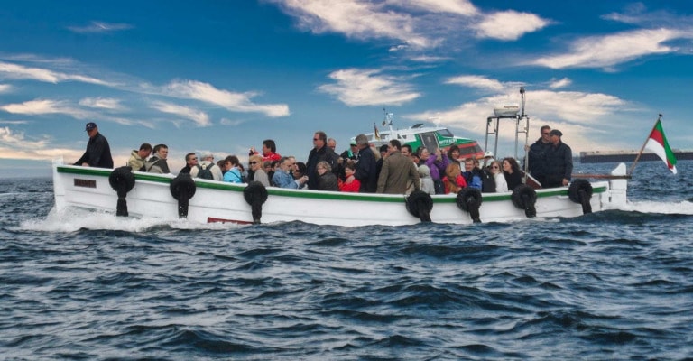
The national park is home to over 50 Islands, including the 5 Dutch Wadden Islands, also known as "pearls in the sea". A trip on a classic sailboat is a real way to experience the mudflats and what it's like to "run aground". It can be treacherous for those unfamiliar with it, but it's also part of what makes it tick.
Ebb and flow
The Wadden Sea is a dynamic and changing environment. The tides and currents play an important role in shaping the ecosystem and the abundance of life within it. The twice-daily influx of water from the North Sea brings with it an abundance of silt and plankton that is left on the sand at low tide. This provides a rich food source for the many different species of algae and kelp that grow here. The shallow, warm water also contributes to the rapid growth of these plants, which in turn provides a rich food source for the many animals and people that call this unique ecosystem home.
Dutch Wadden Sea
The Dutch Wadden Islands are a group of five Islands before the North Sea coast, known for their natural beauty and diversity of plants and animals. The islands of Texel, Vlieland, Terschelling, Ameland and Schiermonnikoog offer breathtaking scenery with quiet, open regions, beaches and dunes, and sweeping views across the North Sea. In addition to their natural beauty, the Wadden Islands also offer a vibrant cultural scene, numerous sports opportunities and cozy cafes with outdoor seating.
The extraordinary diversity of flora and fauna on the islands of Texel and Schiermonnikoog has led to both islands being designated as national parks. The great diversity of flora and fauna on these islands makes them unique and worthy of protection. In particular, the islands are home to many rare and endangered species. By protecting these areas, we can help ensure that these species continue to thrive.
Geology:
The Wadden Sea is a large shallow body of water located between the coast of northwestern Europe and the mainland. It is divided into three different zones: the sublittoral zone, the eulittoral zone and the intertidal zone.
The sublittoral zone is always flooded and contains the main tidal currents and tidal flats that connect it to the open sea.
The eulittoral zone is located around these tidal currents and is characterized by shallower water and more diverse plant and animal life.
The intertidal zone (intertidal zone) is the area between high and low tides and is exposed to the air for part of the day.
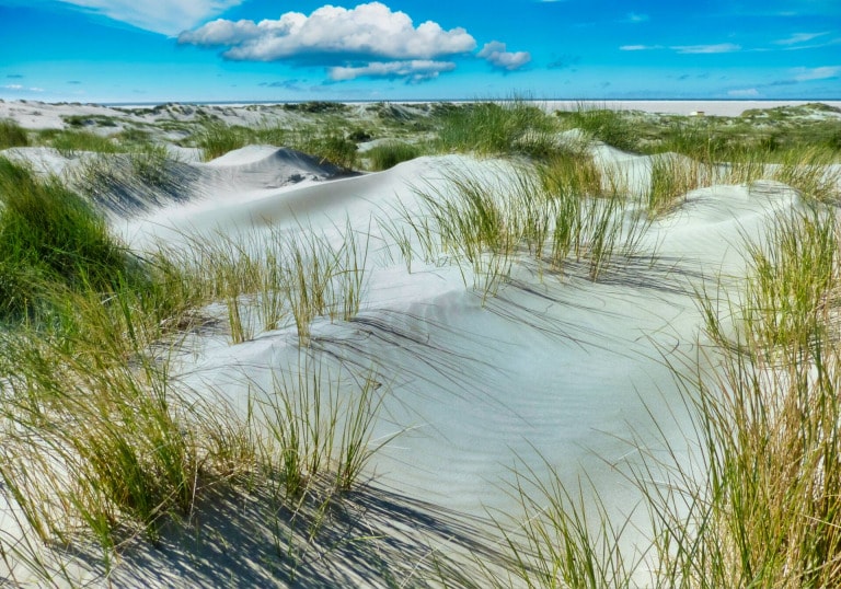
The supralittoral zone is an area that is dry twice a day and is above the water level at low tide, but below the water level at high tide. This is where mussel beds and the home of lugworms are found. Even though the supralittoral zone is higher than the average high tide, it can be inundated during spring tides and storm surges. This area contains salt marshes that are characterized by their unique vegetation and wildlife. The supralittoral zone is an important habitat for many animals and plants. Mussels and lugworms are just two of the many organisms that call this zone home.
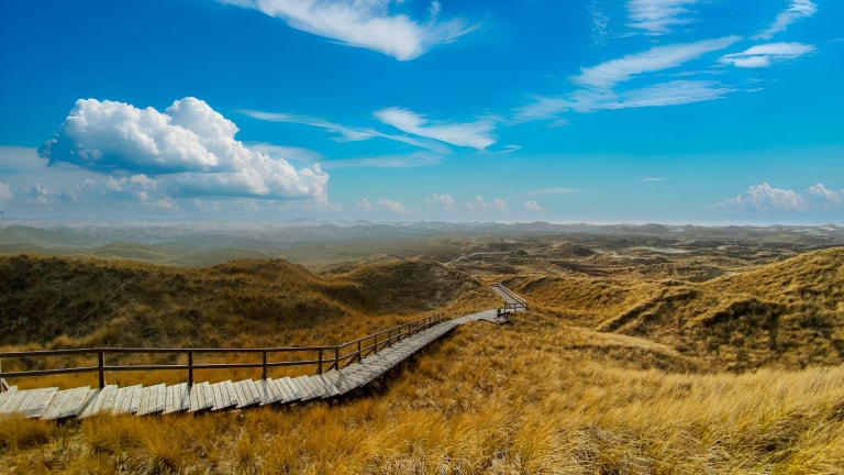
The Wadden Sea in the North Sea is a very young sea from a geological point of view. It was formed in the course of several ice ages, the last of which occurred about 10,000 years ago. The first phase of its formation began with the retreat of the glaciers in Scandinavia, which left behind outwash plains and moraines of rock and debris. Over time, wind and water continued to shape the landscape, eventually forming the Wadden Sea as we know it today.
Geologically, the Geest is a young landscape. It was formed by the last ice age, which ended about 12,000 years ago. At that time, much of northern Europe was covered by thick ice sheets. When the ice sheets melted, they left behind large amounts of debris. These debris masses formed the hills and ridges that make up the Geest today.
The Wadden Sea was formed over a period of several thousand years by the slow but steady rise in sea level after the last ice age. The land that now lies beneath it was once part of the exposed continental shelf.
When discussing the land uplift that occurred in Scandinavia, it is important to consider the role of the glaciers during the last ice age. When the glaciers melted, they lifted the land, causing an uplift of 800 meters. This uplift was accompanied by a corresponding subsidence of the land on the southern shore of the North Sea. This movement caused the sea level to rise, and over the course of several thousand years, more and more silt was able to pile up and form today's flat coastline.
The mechanics of the rise have now slowed considerably, but the general trend is still active. This could increase with a slow rise in sea level due to climate change. This would be a consequence of climate change. If, on the other hand, the water level rises too quickly, the tidal flats will sink and no longer fulfill their function.
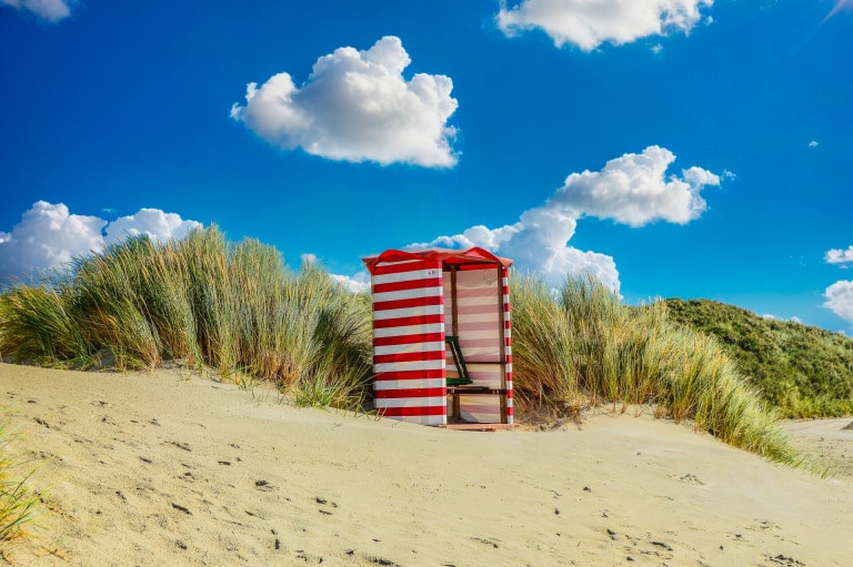
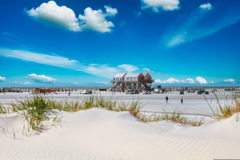
Tourism in the Wadden Sea
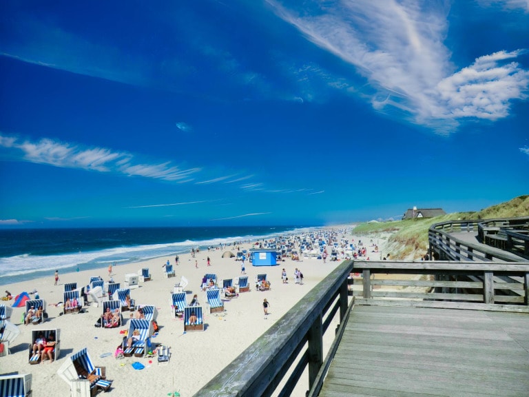
Every year, the national park in Schleswig-Holstein and Lower Saxony is visited by about 10 million tourists, and another 30-40 million come to the North Sea for day trips. Most of these tourists come from the countries directly bordering the Wadden Sea. It is estimated that tourism accounts for about one third of all employment opportunities in the coastal areas.
The Wadden Sea offers high recreational value to the public because of its vast landscape and the tranquility that can be found there. The clean air also contains iodine, which is beneficial for human health. However, access to the is restricted in some areas to protect the natural environment and the wildlife that lives there. In particular, visitors are not allowed to enter designated quiet zones in national parks and nature reserves, or other areas where human activities are known to disturb the local ecosystem.
The tours offered by knowledgeable mudflat guides are a real opportunity to learn about this important ecosystem and appreciate its importance. The tours allow you to see the mudflats up close and learn about the flora and fauna that call them home.