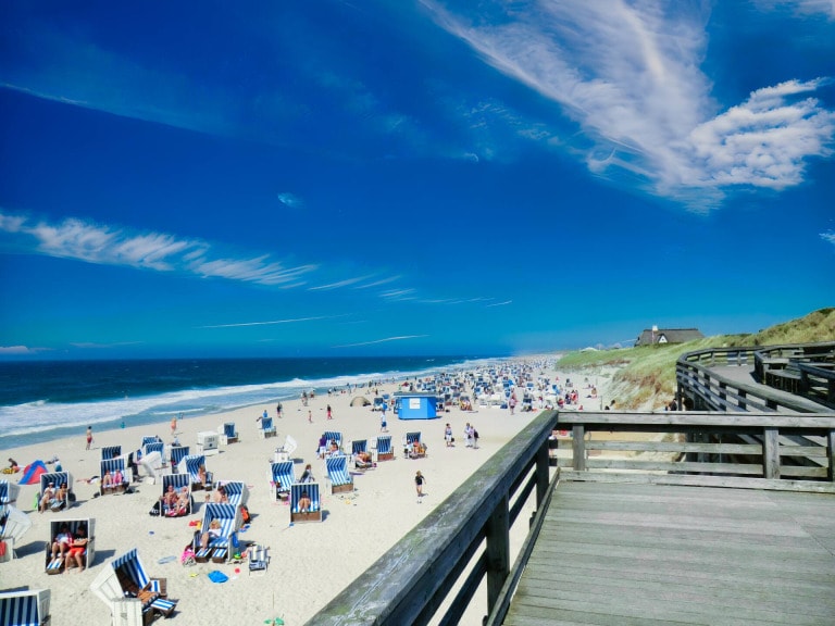
At the most northwestern tip of Germany lie the seven East Frisian Islands. They are among the most popular vacation destinations for Germans. Whether cure on Norderney, rest on Juist or extensive bathing vacation on the huge beach of Borkum. Each finds on one of these original North Sea Islands his own personal highlight!
The formation of the East Frisian Islands - A wild story of constant change

Off the East Frisian peninsula between the mouths of the Ems in the west and the Jade and Weser in the east lies the chain of the East Frisian Islands, which is still in motion today.
They have been shaped by the eternal change of the tides for centuries. From Borkum to Wangerooge they extend for about ninety kilometers at a distance of 3.5 to 10 kilometers from the mainland.
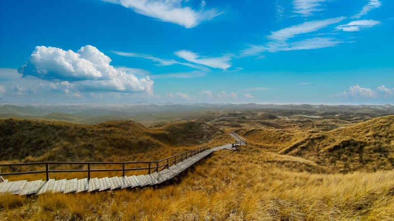
All North Sea Islands have extensive sandy beaches on the northern side of the lake. Towards the center of the island there are sand dunes. They are stabilized and protected by grasses, roses and trees. Towards the south, the islands merge into salt marshes and mudflats.
Since the ice sheets of the last ice age retreated, the North German coast was subject to the forces of the tides. Unlike the islands of the North Frisian were the East Frisian Islands at no time connected with the mainland.
Storms and tides gradually led to the present shapes of the individual islands. The North Frisian ones have a core of marshland. Their East Frisian sisters consist only of sand and are therefore correspondingly unstable.
The tidal current comes from the English Channel in the west. As a result, the East Frisians gradually migrated from west to east. Settlements could only establish themselves after coastal protection measures had slowed down this process enormously. It has not come to a standstill to this day.
Vacations on the East Frisian Islands - a mixture of paradise and wild nature

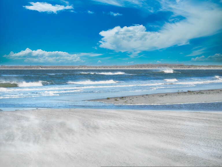
The protection of the islands is still today a constant struggle against the North Sea and the wind.
After every major storm surge, there are dune breaches that have to be replenished as quickly as possible. But it is precisely the wild and pristine that makes the charm that many vacationers find on a North Sea island search. Coupled with the quiet but warm charm of the islanders, the North Sea vacation to an unforgettable experience.
Over the centuries, each East Frisian island developed its own special flair. With almost eleven million overnight stays in 2016, the East Frisian Islands are among the most popular destinations in Germany.
In the middle of the national park "Niedersächsisches Wadden Sea" nature can be experienced up close. Since summer 2009, the region belongs to the "UNESCO World Heritage Site" and enjoys a special protection status.
Long beaches, rough seas, original flora and fauna, all of which can be experienced directly, make for a vacation mix that is unique in Germany.
Borkum - North Sea island with high sea climate and healthy silt

With an area of 36 square kilometers, Borkum is the largest of the seven inhabited East Frisian Islands in the North Sea. Due to its proximity to the Gulf Stream, the island enjoys a particularly mild and restful offshore climate.
A visit to the lighthouse, which is over sixty meters high, is just as much a must for vacationers as enjoying a concert right on the beach with a view of the wide, silver-gray waters of the North Sea.
The local history museum "Dat Dykhus" is located near the old lighthouse. In addition to the impressive 300-year history of Borkum, there is a specially built whale hall where visitors can marvel at a real, 15-meter-long skeleton of a 35-ton sperm whale. Until the end of the 18th century, the inhabitants of Borkum lived exclusively from whaling.
An impressive relic from those times can be admired in Wilhelm-Bakker-Strasse. A fence made of whale pine bones defies the East Frisian weather there to this day.
When the sun is shining, you should take long bike rides through the extensive dunes in the east of the island. From a small viewing platform you can see the neighboring islands Juist and Memmert.
If the weather is rather mixed, you will find everything for real water rats in "Gezeitenland", Borkum's adventure pool. Here, on request, you can also be pampered with a pack of genuine Borkum mud with a healing effect.
Juist - East Frisian island with the longest sandy beach

During the ferry crossing, you'll find plenty of time to get in the mood for your vacation on the North Sea island. In wild zigzag course the ship creeps through the East Frisian mudflats.
Only the artificially created navigation channel enables the supply by ship.
Arriving on Juist, everything is slow and refreshingly quiet. Juist is, like most of the East Frisian Islands (except Borkum and Norderney) car-free. All transportation takes place by horse and carriage.
The accommodation can be reached on foot or by horse cab. When the rhythmic clacking of hooves can be heard, the vacation feeling comes all by itself.
The main village begins only a few meters from the harbor. Here and in the "Loog", which is located in the far west, live about 1500 inhabitants.
You can experience pure nature during an extended walk to the outermost tips of Juist. Both at the "Bill" in the west, as well as at the "Kalfamer" in the east, seals often lie in the sun.
With a bicycle Juist can be explored quickly and comfortably. At 17 kilometers, the East Frisian island of Juist is the longest of the seven islets. The fine sandy beach stretches along the entire north side.
You can enjoy the most beautiful view over the entire island in the glass dome of the Kurhaus or on the viewing platform of the Juist landmark directly at the harbor.
Norderney - Lively North Sea island for active vacations

The East Frisian island of Norderney is the most populous island with about 6000 inhabitants.
The town of Norderney is located in the far west. It is protected from storm surges by a large sandy beach to the north and an island revetment to the west.
The revetment also serves as an elegant promenade. Tea rooms and restaurants here offer regional delicacies as well as a magnificent view of the expanse and waves of the North Sea.
Norderney is a turbulent island with a city character. The pedestrian zone offers plenty of opportunities for shopping and fun.
Every Whitsun weekend, the annual sports and party event "White Sands" takes place. A real highlight in the calendar of events, with beach volleyball tournament and windsurfing competitions.
Those who like it more contemplative should explore the tranquility of the extensive dune landscape by bike. Dunes and horse pastures form a charming contrast with the blue sky and the gray sea, which provides the typical East Frisian colors.
In the middle of the dunes is the only 9-hole golf course on the islands.
If your beach walk takes you to the eastern tip of Norderney, you may be lucky enough to see wild seals up close. Together with the screeching seagulls, this all forms the perfect backdrop for your unique North Sea vacation on Norderney.
Baltrum - Sleeping Beauty of the North Sea

Baltrum is affectionately called the "Sleeping Beauty of the North Sea" by its 600 inhabitants. That sums it up very well.
As the smallest member of the East Frisian island family, it lies exactly in the middle of the island chain. Time seems to stand still here. Baltrum's charm lies in its original atmosphere and manageability.
The village is divided into Westdorf and Ostdorf. One looks for street names here in vain. A number on each house is enough to find your way around.
Baltrum is perfect for a day trip.
The ferry runs regularly from Neßmersiel. The journey time is only about twenty minutes.
Baltrum can be easily explored on foot in one day. You should definitely visit the well-kept rose garden. What is special is not its size or variety, but its location in a pine grove in the dunes.
In winter or on rainy days, a visit to the adventure pool "SindBad" is a good idea.
Those who wish to stay longer can be pampered at the Thalasso North Sea spa.
In a few hours, the entire island is circumnavigated. Just breathe in and out slowly on the beach. You will immediately feel peace and serenity take possession of you. Watch the seagulls in the wind and experience the eternal change of high and low tide.
Langeoog - mudflats, nature and East Frisian coziness

Due to the ferry connection, which is independent of the tide, is Langeoog can be reached at any time as a day trip. The small island train brings the vacationer from the harbor to the center of the village.
The unique natural landscape is the largest Sight of this North Sea island. Due to the elongated shape from west to east can be observed on Langeoog, as on no other island of the East Frisian, dunes in your formation.
On foot, by bike or on horseback you will experience this attraction up close.
Langeoog's landmark is located on the dunes.
A water tower built in 1909 that houses an exhibition about the islands' water supply.
The viewing platform at a height of 30 meters offers an unforgettable 360° panorama. Mainland, dunes, mudflats and wide sea, everything can be overlooked from here. From Norderney to Wangerooge are many lighthouses to discover.
Not far from the water tower, the attentive walker will find a small bronze figure leaning against a lantern, looking out over the water. It was erected in honor of the German singer Lale Andersen (Lili Marleen).
She fled to Langeoog shortly before the end of the war. Her grave can also be found in the small island cemetery.
After a refreshing excursion into the nature of Langeoog, many well-kept restaurants and cozy tea rooms are recommended in the village. From fresh North Sea fish to the East Frisian hearty raisin cake with rum, no wish remains unfulfilled.
Spiekeroog - peace and nature in the UNESCO World Heritage Site

The departure times of the ferry from Neuharlingersiel are tide-dependent. However, the short journey time through the East Frisian Wadden Sea for the fact that almost always a day trip to Spiekeroog is possible.
A long beach in the north and wide salt marshes in the south offer unspoiled nature. The dune landscape provides every North Sea vacationer with beach grass, wild roses and even small forests for ever new, varied impressions.
The village is located in the center of the island. Its numerous listed houses provide the special flair of Langeoog. Take your time to discover the small, loving details of the old houses.
Above the tourist information "Kogge" is the curious shell museum. The interested guest can marvel at over 2000 shells and snails from all over the world.
Spiekeroog is a recognized Thalasso North Sea spa. If you are looking for relaxation and rest from everyday life, you are in good hands here. The seawater indoor swimming pool allows you to exercise. A subsequent visit to the Kurmittelhaus provides relaxation with wellness and Thalasso treatments.
In the evening, enjoy a "cool blond" or a hot cup of "East Frisian tea" with cracking rock candy and cream clouds. So the vacation mood comes over you all by itself.
Wangerooge - island in the grip of the tides

The East Frisian island of Wangerooge is the easternmost of the islets. It lies directly on the western estuary bank of the Jade. Wangerooge has the most geographically turbulent history of the seven islands off the East Frisian mainland.
Again and again, homes and buildings on the western edge had to be abandoned to the sea and rebuilt in the east of the island.
Today, the island body is protected by natural dunes and man-made revetments.
Guests reach the North Sea island with the tide-dependent ferry from Harlesiel. After a tranquil journey of just under an hour through the Frisian mudflats, the journey continues by island train.
During the 20-minute train ride, the landscape puts the vacationer in the mood for the peace and deceleration that awaits him on the island of Wangerooge.
In case of inconvenient ferry times, the island pilots at the airfield in Harlesiel offer a quick alternative.
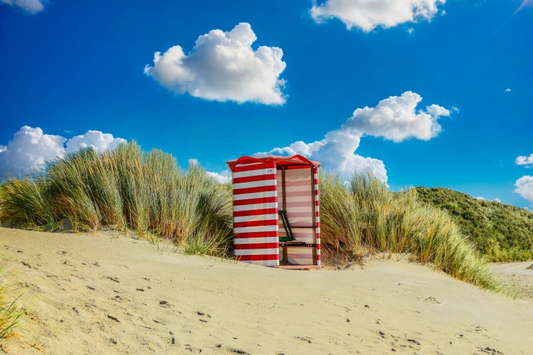
If you finally want to relax and read a book or build sandcastles with the kids, Wangerooge beach is the place to be!
In a comfortable beach chair, protected from the wind and sun, you can relax and enjoy the beach life.
As on all islands, a lot of emphasis is placed on your health here on Wangerooge. Leave your everyday worries behind on the mainland and relax with cures, Thalasso treatments or massages.
More small islands and sandplats
Bant - Submerged North Sea island in tidal current
The island of Bant was inhabited until the 16th century. There, table salt was extracted from salt peat.
The resulting erosion caused the island to break up and wash over. Geologists suspect that Bant was much larger and reached as far as today's Borkum Reef.
After the city of Emden had erected a navigation marker on Bant in the mid-18th century, it was completely washed over in 1780.
Today, all that remains of the old island is a sandbar for resting seals and birds.
Brewerplate - An uncertain fate
The Brauerplate is a large sandbank with parts of high sand. It is located three kilometers north of Borkum in the estuary of the Osterems.
For some time now, the Brauerplate can also be perceived from Borkum as an island-like structure. Due to strong movements in the course of the Osterems current, the entire morphological shape of the North Sea, north of Borkum, changes.
Since man does not intervene here, the further development of the brewery plateau is uncertain.
Kachelotplate - A constant up and down in the grip of the forces of nature
The Kachelotplate was first marked on a map as early as 1840. It is a high sand and lies about five kilometers southwest of the island of Juist.
In 2004, it reached an area of 230 hectares.
Already in 2006, it had lightly vegetated dunes about 2.5 meters high. However, the heavy hurricane floods in the fall of 2006 destroyed these again. Since then, it has been migrating towards Memmert Island, with which it will probably merge.
Lütje Hörn - Fast North Sea island in the Borkum tidal flat ridge
The uninhabited island "Lütje Hörn" is located about four kilometers east of Borkum. Due to the influence of the Osterems estuary current, Lütje Hörn is oriented north-south.
Due to storms and ocean currents, Lütje Hörn migrates steadily to the southeast. In the process, it covered more than six hundred meters between 1961 and 1999 alone. In terms of area, the island continues to shrink. Both the vegetation and the number of breeding birds are decreasing in parallel with the loss of area.
Memmert - bird island with one inhabitant
After the first mention in 1650 Memmert had a steep career!
Beginning as a sandbar, it is now an amazingly stable, vigorously vegetated island with dunes up to eight meters high. In 1907, the government declared Memmert a protected bird colony.
Since 1921, the colony has been guarded and the birds counted by a bird warden during the season from March to November. Memmert lost a lot of land in the stormy 1960s.
Buise - The missing North Sea island
There are only very incomplete records about the location and size of the old island of Buise. One has to rely on conjectures for the historical classification.
Buise is said to have been very large. During a storm tide in 1362, it broke in two. Since Buise is mentioned before Norderney, historians assume that Norderney originated from the eastern half.
Storm surges and tidal currents gradually carried away the western part.
Minsener Oog - Created by humans
The island of Minsener Oog was formed by the merging of two sandbanks. At the beginning of the 20th century groynes were built on Minsener Oog.
The aim was to prevent the Jade estuary from silting up. The flushing of 10 million cubic meters of sand from the Jade also served this purpose.
As a result, the island of Mindener Oog reached its current size of 370 hectares with a 12-meter high dune landscape. In summer, mudflat walkers can visit a small part of the island.
Mellum - The youngest North Sea island
The island of Mellum developed from a high sand at the end of the 19th century. Mellum was formed on the watershed of the Jade and Weser rivers off the Butjadingen peninsula.
During the Second World War, an anti-aircraft gun was stationed behind a small dike. At that time, native woody plants were planted, which multiplied rapidly. Today, mainly various species of gulls breed here.
Mellum and the adjacent mudflat area are important seal habitats.
The only person on Mellum is the bird keeper with his own little house.